Peña de los Enamorados: Where a Rock Profile Watches Over the Dolmen of Antequera
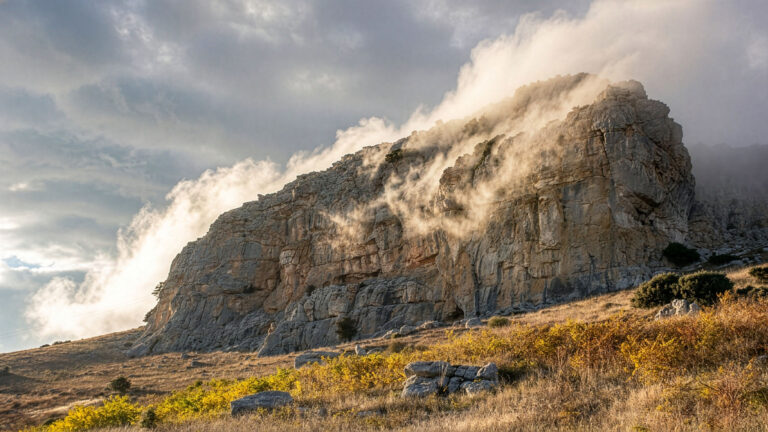
Anyone arriving in Antequera for the first time and approaching the town along the A-92 cannot miss it: a table mountain to the north, whose silhouette looks like a reclining face against the sky. Forehead, nose, lips, beard – the outline is so unmistakable that even visitors need no prompting to spot it. Locals call it La Peña de los Enamorados, the Lovers’ Rock, and the name refers to a legend documented in the 16th century. Scientifically more interesting, however, is what the mountain has officially been since 2016: a piece of UNESCO World Heritage.
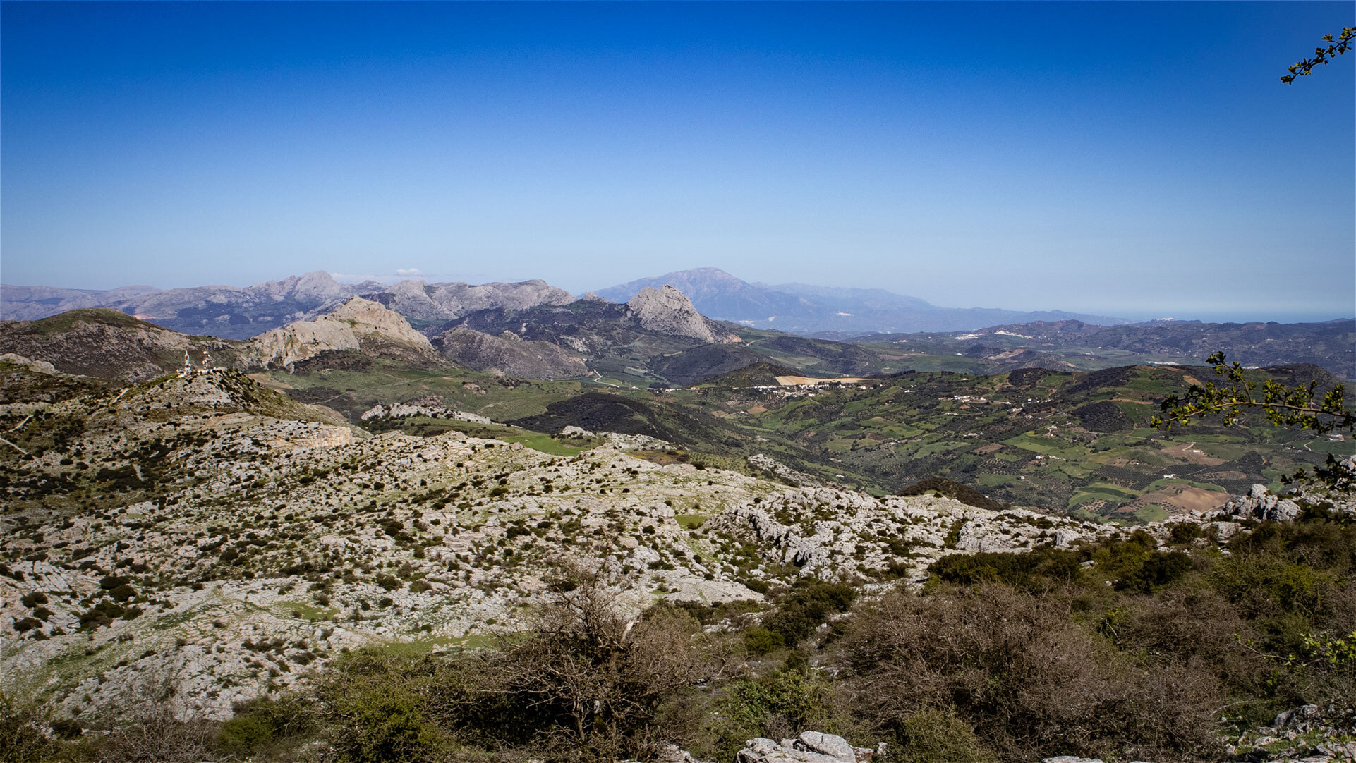
Its inclusion in the UNESCO World Heritage Site “Antequera Dolmens Site” is remarkable, because the Peña is not a man-made monument but a natural monument. Together with the three dolmen sites of Menga, Viera and El Romeral, as well as the karst massif of El Torcal, it forms a World Heritage Site in which megalithic architecture and landscape merge into a unity that is unique in Europe. The Menga dolmen is aligned with the summit of the Peña – an indication that the rock was already venerated as a cult object more than 6,000 years ago.
What makes up the mountain geologically, what archaeological traces can be found on its summit, how the connection to the Menga dolmen works, and whether a trail leads to the top – the key answers about Antequera’s most famous landmark.
The Mountain: A Table Mountain with an Indian Profile
Geology, Size and the Famous Silhouette
The Peña de los Enamorados is a free-standing table mountain roughly 880 metres above sea level. Geologically, it belongs to the same Jurassic limestone strata that also make up El Torcal – a sediment of the Tethys Sea that formed 150 to 200 million years ago and was pushed to the surface by the Alpine orogeny. Unlike the karst labyrinths of El Torcal, however, the Peña has retained its tabular layering: it stands as a compact block in the landscape, with almost vertical cliffs to the south and a gently sloping ridge to the north.
The famous silhouette is at its most striking when seen from the A-92 or from the Mirador de la Peña above Antequera. The profile is so distinct that in the English-speaking world it is sometimes known as “Lover’s Rock” or “The Indian” – the shape does indeed resemble the head of a reclining native American with a pronounced brow line. Once you have seen it, you keep seeing it. The Spanish themselves usually just call it “la Peña” – the rock.
| Height | approx. 880 m above sea level |
|---|---|
| Location | 5 km north-east of Antequera |
| Geology | Jurassic limestone, approx. 150-200 million years old |
| Character | Table mountain with almost vertical south and west faces |
| Silhouette | reclining face / Indian profile – most distinct from the south |
| Protected status | UNESCO World Heritage Site since 15 July 2016 |
| Archaeology | prehistoric rock carvings on the summit |
UNESCO World Heritage: Why a Mountain Is Protected
The Alignment of the Menga Dolmen with the Summit
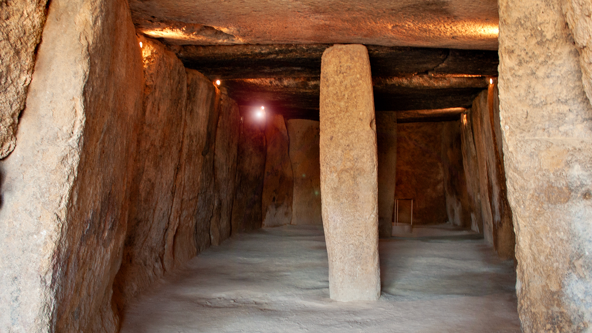
What makes the mountain a UNESCO site is neither its geology nor its silhouette. It is its archaeological connection to the nearby dolmen sites. The Dolmen de Menga – one of the largest megalithic tombs in Europe, built around 5,000 BC – is not oriented by chance but aligned with the summit of the Peña. Such an alignment with a natural landmark is unique in a European context: dolmens are usually oriented according to compass directions or astronomical points, not mountains.
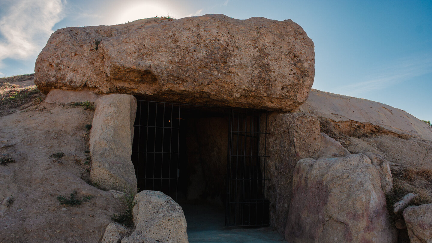
There is also an astronomical component. At the summer solstice, on 21 June, the sun rises behind the summit of the Peña and shines directly through the entrance passage into the burial chamber of the Menga dolmen. An effect that cannot be coincidental – the dolmen was built so that this play of light occurs exactly once a year. For the Neolithic society that built the dolmen, the Peña must have been far more than a striking mountain. It was a sacred point in space where earth, sky and death could be connected.
UNESCO’s 2016 justification names three components as a joint World Heritage Site: the three dolmen sites of Menga, Viera and Tholos de El Romeral, the El Torcal Nature Park, and the Peña de los Enamorados. UNESCO explicitly emphasises what is unique about this interplay: the direct link between human construction and natural landscape to form a prehistoric astronomy. There is no other site on the entire World Heritage List where this connection is documented with such clarity.
Summer Solstice at the Menga Dolmen
On 21 June, and for a few days before and after, the sun rises behind the summit of the Peña de los Enamorados. Anyone wanting to experience this play of light inside the Menga dolmen should enquire well in advance – the Conjunto Arqueológico Dólmenes de Antequera regularly organises special solstice tours, which fill up quickly.
Enquiries about events can be made directly through the Junta de Andalucía (museosdeandalucia.es) or the Antequera Tourist Information Office, Plaza de San Sebastián 7.
To the Summit: Hike, Rock Carvings and Views
What Visitors Find on the Mountain
The Peña is not just a photo subject from below – it can also be climbed. A trail leads up to the summit from the north side, less demanding than the vertical cliffs to the south might suggest. The climb is steep, and the final sections require a good head for heights in places, but it is manageable for fit walkers without particular climbing experience. The route is one of the local classics and is often undertaken as a half-day trip from Antequera.
| Starting point | North side of the mountain, accessed via the MA-4413 near Archidona |
|---|---|
| Distance | approx. 5-6 km for the ascent and descent · linear |
| Elevation gain | approx. 350-400 metres of ascent |
| Duration | 2.5 to 3.5 hours including breaks |
| Difficulty | moderate · steep towards the summit with short scrambling passages |
| Equipment | sturdy hiking boots · water · sun protection · no sandals |
| Best time | October-May · difficult in summer after 9am due to the heat |
Up on the plateau lie several archaeological traces. Rock carvings, whose exact dating is disputed, can be found in half-hidden niches. Remains of old wall structures and smaller Neolithic finds point to continuous ritual use of the mountain over several millennia. The finds are not spectacularly large, but they are central to interpreting the World Heritage Site – they make clear that the Peña was not just a visual landmark but was actively climbed and linked to rituals.
On a clear day, the view from the summit stretches far. To the south, the valley of Antequera opens up with the town and, in the background, the karst massif of El Torcal. To the north lie olive groves, with the Sierra Subbética beyond. To the west, the hill ranges towards the Caminito del Rey; to the east, the Sierra Nevada. Anyone planning to combine the climb with the summer solstice should consider the official tours at the Menga dolmen instead of an individual ascent – the connection between dolmen and mountain is often more striking from below than from above.
Conclusion: A Natural Monument That Became a Cultural Monument
The Peña de los Enamorados is one of the most unusual World Heritage features in Europe: a mountain protected not for its geology but for its archaeological connection to a 6,000-year-old structure at its foot. The alignment of the Menga dolmen with the summit makes the Peña an example of how prehistoric societies did not merely use the landscape but incorporated it into their cosmology. It is a connection that concerns every visitor to Antequera – even if you see neither the dolmen nor the mountain up close, but take in both together from a distance in a single glance.
One final recommendation: anyone spending a week in Antequera should observe the Peña at at least three different times of day. In the morning, backlit from the east, the silhouette is at its sharpest. At midday, the mountain looks flat and massive. In the evening, when the sun from the west turns the cliffs orange, the Peña reveals its strongest atmospheric effect – and the connection to the landscape that earned it UNESCO World Heritage status in 2016 becomes immediately tangible.
More on the region: the most important dolmen aligned with the Peña: Dolmen von Menga. The town of Antequera as a location: Antequera Spanien. The karst landscape of El Torcal as the third element of the World Heritage Site: El Torcal de Antequera. The legend that gave the mountain its name: Legende der Liebenden vom Peña.
Frequently Asked Questions about the Peña de los Enamorados
Why is the mountain called the "Lovers' Rock"?
Can you actually climb the Peña?
What is there to see on the summit?
What is the best way to get to the Peña?
When is the best time to visit?
This article is based on the on-the-ground knowledge of the Gequo editorial team – publishers of several Reisezeit hiking guides and operators of Sunhikes.com. As of: May 2026