UNESCO World Heritage Antequera Dolmenss Site: why building and nature are protected together here
There are UNESCO World Heritage Sites for historic old towns. There are some for unique buildings. And there are some for untouched nature. What sets Antequera apart is a rare combination: here, megalithic structures built by human hands are protected together with two natural landmarks – not by coincidence, but because without the latter, the former would be half-empty structures. Anyone who understands Menga, Viera and the Tholos also needs to know what they point towards.
The Antequera Dolmenss Site — officially the Sitio de los Dólmenes de Antequera, or in German the Dolmensstätten von Antequera (Dolmens Sites of Antequera) — has been a UNESCO World Heritage Site since 15 July 2016. It is Andalusia’s seventh World Heritage Site, and it is unique on the entire World Heritage List because it brings together three dolmens, a mountain and a nature park within a single protected area.
What connects the five components is a piece of astronomical logic that is 5,000 years old. What that logic is, and how to visit the site today – step by step through the five components.
Fact file – the UNESCO site at a glance
| Official name | Sitio de los Dólmenes de Antequera (English: Antequera Dolmenss Site) |
|---|---|
| German name | Dolmensstätten von Antequera (Dolmens Sites of Antequera) (Dolmens Sites of Antequera) |
| Inscription on the World Heritage List | 15 July 2016 |
| Rank in Andalusia | the region’s seventh UNESCO World Heritage Site |
| Components | Three dolmens · Peña de los Enamorados mountain · El Torcal nature park |
| Dolmenss | Dolmens de Menga · Dolmens de Viera · Tholos de El Romeral |
| Age of the dolmens | built between 5,000 and 2,200 BC (Neolithic to Early Bronze Age) |
| UNESCO justification | “among the best-known and most famous in the world” (UNESCO dossier, 2016) |
| Uniqueness | the only World Heritage Site that combines megalithic structures with natural monuments |
| Management | Junta de Andalucía (museosdeandalucia.es) |
Component 1: The three dolmens
Menga, Viera and the Tholos de El Romeral
At the heart of the World Heritage Site stand three megalithic burial monuments on the outskirts of Antequera. They lie so close together that they can be visited in half a day – yet they differ fundamentally in construction and symbolism.
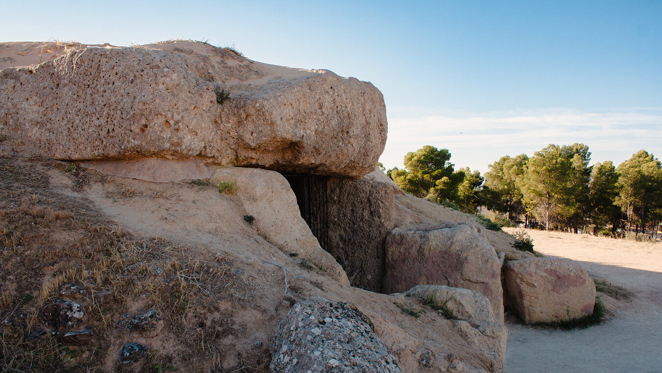
The Dolmens de Menga is the most spectacular of the three monuments and is considered the largest dolmen in Europe. Its capstone weighs around 180 tonnes – how this load was moved 5,000 years ago without modern technology remains a subject of research to this day. The entrance corridor is aligned exactly with a point on the horizon that coincides with the Peña de los Enamorados – astronomy built into stone.
The Dolmens de Viera lies right next to Menga and represents the more classically aligned variant: its corridor faces east, so that at the equinox the sun shines directly through the entrance into the burial chamber. This eastward orientation is common among Neolithic megalithic structures – making the Viera dolmen the rule-abiding counterpart to Menga’s unusual alignment.
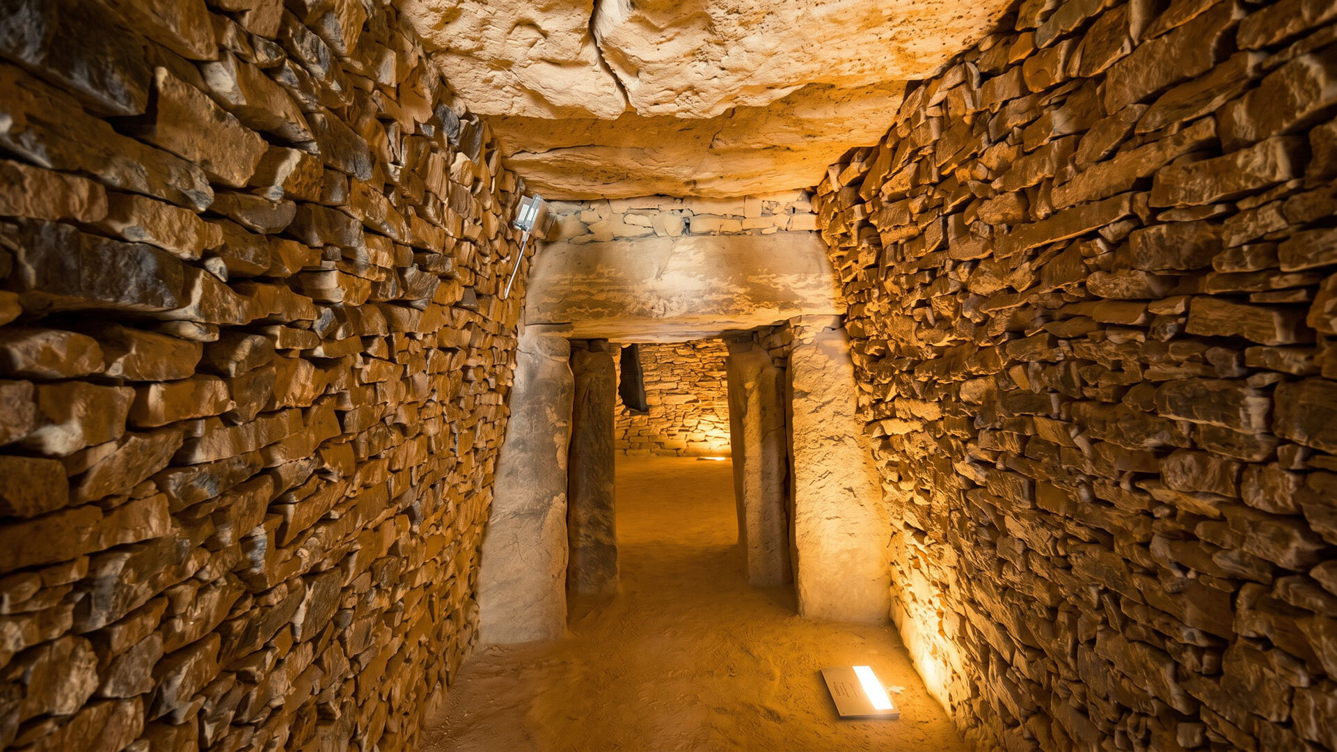
The Tholos de El Romeral stands around 2 km from Menga and Viera and follows a different construction principle: a beehive tomb. The 26-metre-long passage leads into a round chamber whose ceiling is formed of ever-narrowing rings of stone that curve upwards – a corbelled dome, held up by an earth mound 68 metres wide. A second, smaller chamber, with its opening offset by 10 degrees, is flooded with precise light at the winter solstice – the back wall becomes a stage for the sun.
Component 2: Peña de los Enamorados
The mountain the Dolmens de Menga points towards
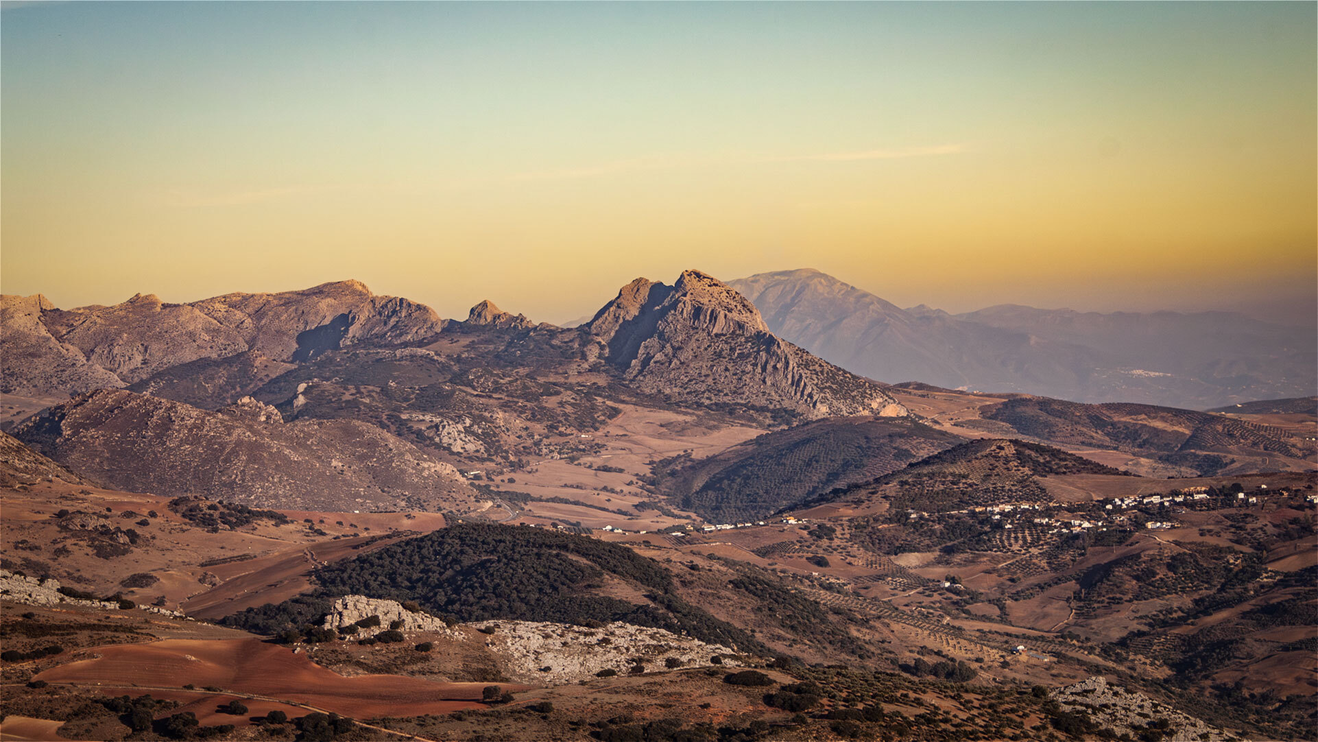
North of Antequera rises a distinctive table mountain whose silhouette resembles a reclining human profile: the Peña de los Enamorados, the “Lovers’ Rock”. Some guidebooks also describe the shape as an “Indian’s head”. The mountain is not just a landmark of the town, but a central component of the UNESCO World Heritage Site.
The reason: the entrance corridor of the Dolmens de Menga is aligned exactly with the summit of the Peña. This is unique in continental Europe – no other megalithic structure of this scale points towards a natural landmark. At the summer solstice, the sun rises behind the mountain’s summit and shines directly into the entrance of the Dolmens de Menga. Anyone standing at the entrance early on that day witnesses a spectacle that took place with the very same precision 5,000 years ago.
The Peña is not just a sightline, but an archaeological site in its own right. Prehistoric rock carvings have been discovered on the rock face – evidence that the mountain was a place of worship for centuries, long before the first stone was raised for the dolmens. A footpath leads to the top, offering wide views as far as the Sierra Subbética and – on a clear day – to the Mediterranean.
Component 3: El Torcal Nature Park
The karst landscape the Tholos points towards
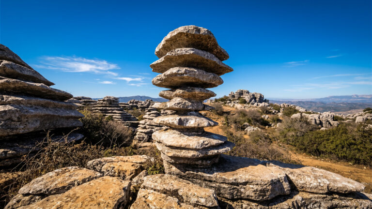
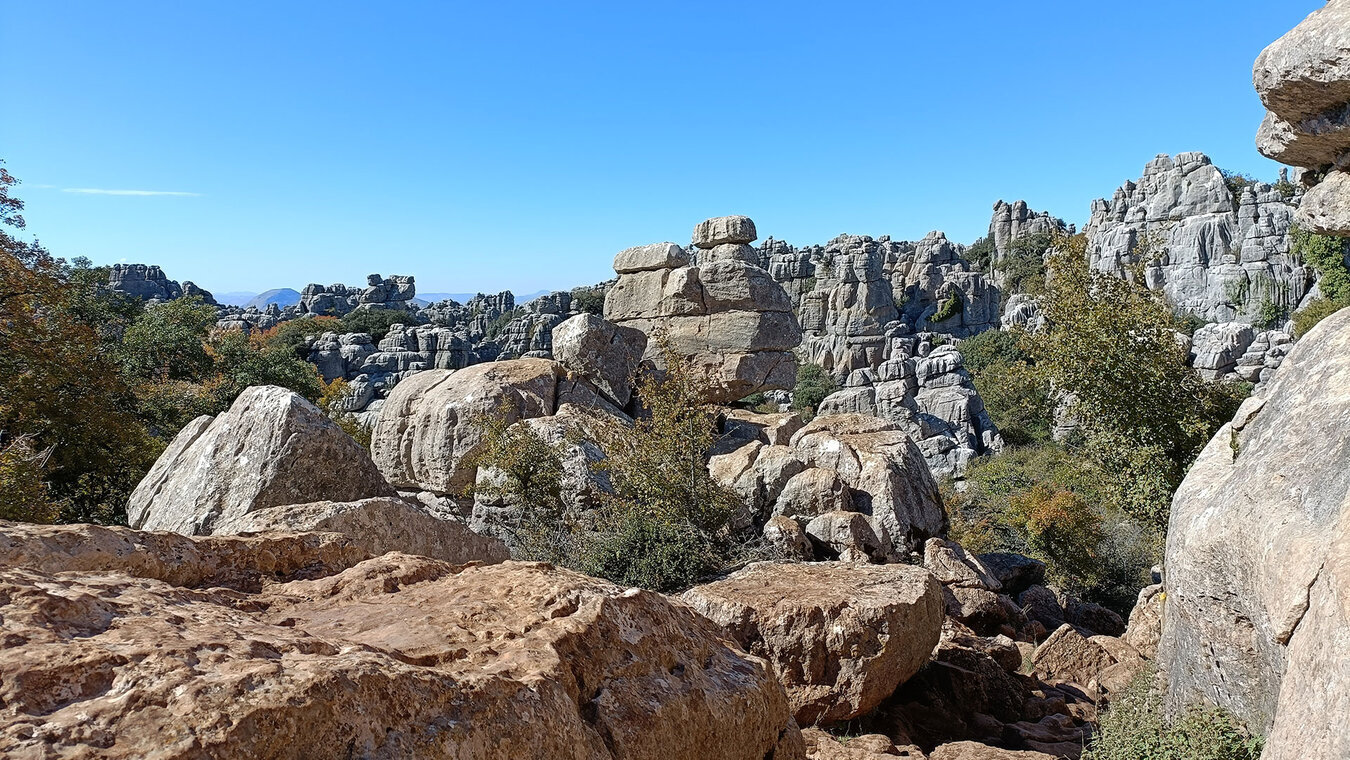
While the Dolmens de Menga is aligned with the Peña, the Tholos de El Romeral points in a different direction: towards El Torcal, more precisely towards the Camorro de las Siete Mesas, a distinctive karst peak in the south of the nature park. The alignment runs at 199° south-west, which is unusual for the Iberian Peninsula – a sign that the builders were not simply following the local convention but were deliberately pointing towards the natural monument.
El Torcal has been a Paraje Natural since 1978 and forms part of the arcing Sierra Subbética range. On the karst plateau, at heights of between 1,100 and 1,400 metres, bizarre rock pillars rise up, formed from Jurassic limestone that was laid down on the bed of the Tethys Ocean 150 to 200 million years ago. This bridge between a Neolithic burial monument and geology 150 million years old is what makes the World Heritage Site unique.
Unlike the dolmens and the Peña, El Torcal is accessible across a wide area. The nature park has a visitor centre, waymarked trails (Ruta Verde, Ruta Amarilla) and more than 100,000 visitors a year. Anyone bearing the UNESCO logic in mind sees a walk there differently: as a visit to the natural half of a building-and-nature ensemble.
The truly unique element: prehistoric astronomy
Why this World Heritage Site stands alone on the list
UNESCO World Heritage Sites are listed under clear categories: cultural heritage, natural heritage, mixed heritage. The Antequera Dolmenss Site does not fit neatly into any of the usual boxes. It is inscribed as cultural heritage, yet it also protects two natural monuments – because their cultural significance only becomes visible through their connection to the dolmens.
This is UNESCO’s central justification: 5,000 years ago, a concept was built here in which architecture, nature and astronomy form a single whole. The Dolmens de Menga points towards a mountain that becomes significant at the summer solstice. The Tholos points towards a karst peak in which a light axis is activated at the winter solstice. Together, the two form an astronomical annual cycle worked into the landscape.
Such constellations occur occasionally around the world – Stonehenge, for instance, or Newgrange in Ireland. What makes Antequera unique is the combination: three structures, two reference points, clear alignments to four key times of the year. There is no second site with this combination anywhere on the World Heritage List.
Who built this – and when
The people behind the stones
The dolmens were built by farming communities who lived in the fertile Guadalhorce Valley between 5,000 and 2,200 BC – Neolithic to Early Bronze Age cultures. The nearest settlement was Cerro de Marimacho, around 200 metres east of today’s dolmen sites.
Building a single dolmen of this scale required the resources of several settlements to be coordinated. The 180-tonne capstone of the Dolmens de Menga alone required hundreds of workers, a technical plan for transport and erection, and an organisation capable of sustaining several years of construction. What we today call “prehistoric” was in fact a society with a complex social structure and considerable feats of engineering.
How these people linked their astronomical observations to the choice of building sites remains a subject of research. What is clear is this: a deviation of just 0.5 degrees at the Dolmens de Menga, and the sun would no longer meet the Peña.
Visiting the three components today
Practical overview
The three components can be combined over two to three days – their proximity to one another makes a sensible route possible.
The three dolmens are managed by the Junta de Andalucía. At the main site (Menga and Viera) there is a modern visitor centre with a museum – watching the short introductory film before the tour gives a much clearer understanding of the scale and astronomical significance. Both dolmens can be visited in a single trip; the Tholos de El Romeral lies around 2 km away and requires a separate journey.
Opening hours vary by season – in summer, because of the heat, there is often a longer midday break, but the site stays open later in the evening. It is usually closed on Mondays. Admission is free for EU citizens; non-EU citizens usually pay a small fee of around €1.50. Check current times and any booking requirements on museosdeandalucia.es shortly before you travel.
The Peña de los Enamorados can be reached via a footpath from the valley. The route is moderately demanding and is best walked in the cooler months (October–April) or early in the morning. From the plateau there are wide views towards Antequera and El Torcal – standing at the top, you can see for yourself just how close together the three components lie.
El Torcal is the most accessible component. The visitor centre and footpaths are free of charge – a fee is only charged for the car park in high season. A half-day walk along the Ruta Verde or Ruta Amarilla reveals the karst landscape that the Tholos was aligned with 5,000 years ago.
Conclusion: a World Heritage Site that can only be understood as a whole
The Antequera Dolmenss Site is more than three dolmens plus two mountains. It is a spatial composition of building and nature erected 5,000 years ago – and that is precisely what makes it unique on the UNESCO list.
Anyone who visits only the Dolmens de Menga sees an impressive megalithic tomb. Anyone who bears the UNESCO logic in mind sees a structure that points towards a mountain behind which the sun rises at the summer solstice. Anyone who continues on the same day to El Torcal and looks towards the Camorro de las Siete Mesas completes the circle – the natural monument that the Tholos targets at the winter solstice.
Weiter zum Dolmens von Menga, zum Dolmens von Viera, zum Tholos de El Romeral, zur Peña de los Enamorados und zum Paraje Natural Torcal de Antequera. Back to the El Torcal overview
Frequently asked questions about the UNESCO World Heritage Site Antequera Dolmenss Site
When did Antequera become a UNESCO World Heritage Site?
What exactly does the UNESCO World Heritage Site cover?
Why are El Torcal and the Peña part of the World Heritage Site – and not just the dolmens?
How old are the dolmens?
Does visiting the World Heritage Site cost anything?
This article is based on the on-the-ground knowledge of the Gequo editorial team – publishers of several Reisezeit hiking guides and operators of Sunhikes.com. Last updated: May 2026