Desfiladero de los Gaitanes: Andalusia’s deepest gorge – pure nature at 400 metres
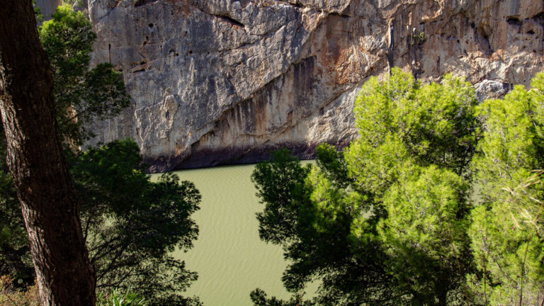
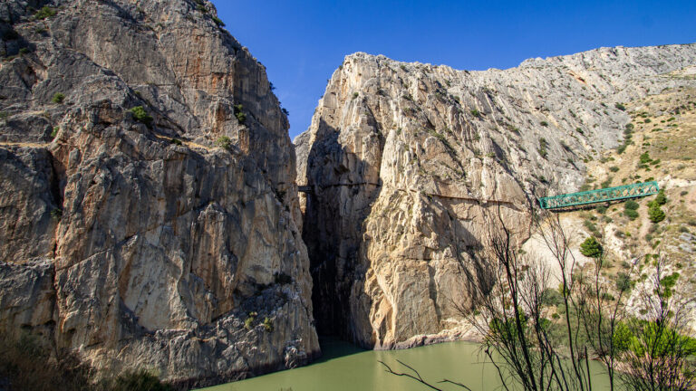
There are places you see once and never forget. The Desfiladero de los Gaitanes is one of them. About 40 kilometres west of Antequera, the Río Guadalhorce has cut a gorge into the limestone that is up to 400 metres deep and, in places, barely 10 metres wide. Rock faces rise like vertical cathedrals, the river appears as a dark ribbon far below, and overhead bearded vultures circle in loops of almost unimaginable size. This gorge is no mere backdrop – it is a natural wonder in its own right.
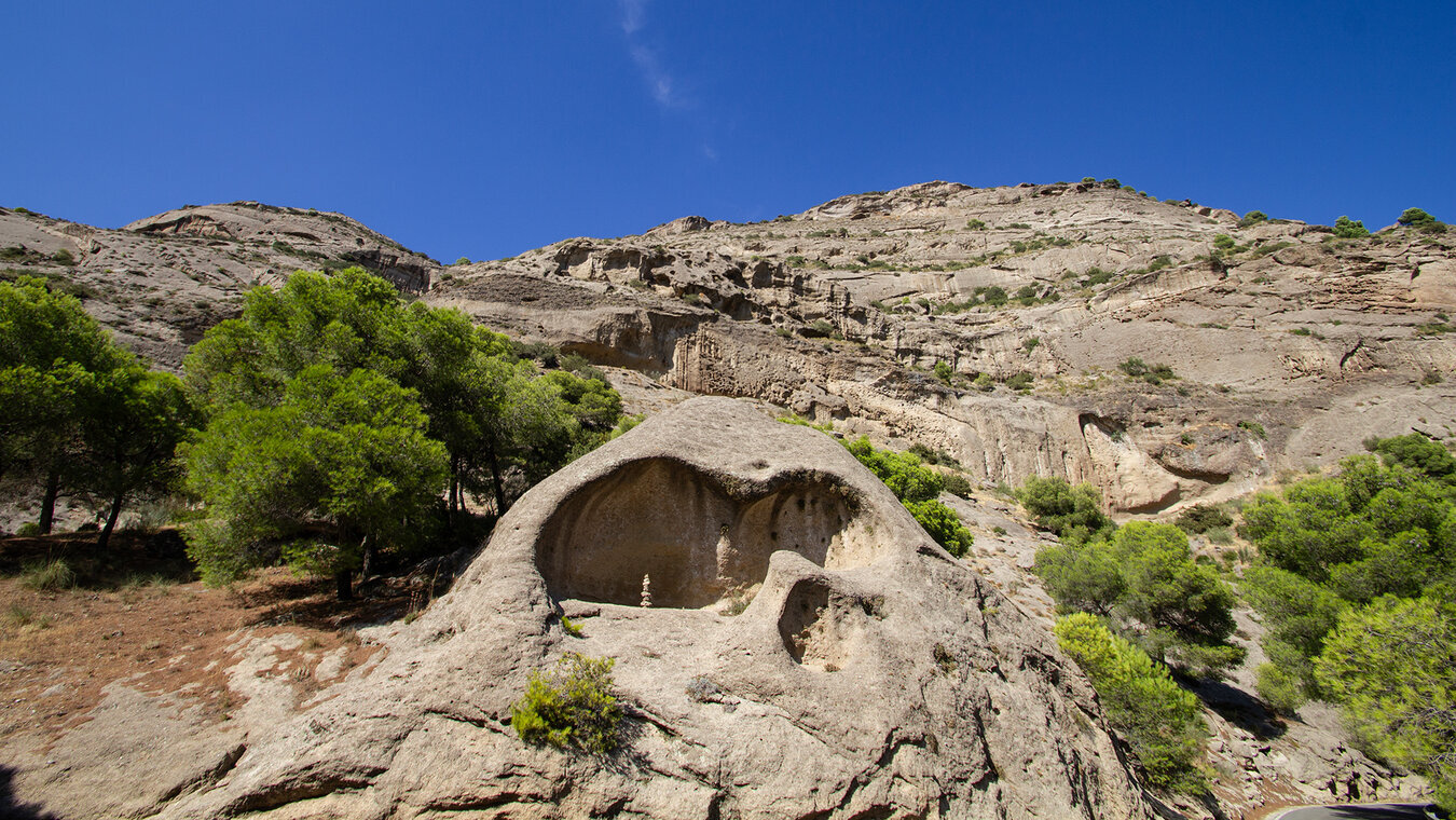
At 2,016 hectares, the Paraje Natural Desfiladero de los Gaitanes is the largest nature reserve in the province of Málaga. Protected since 1989 and also designated a Special Protection Area for birds (ZEPA) since 2002, it is home to one of the densest populations of birds of prey in southern Spain. Visitors here experience not only extraordinary geology – they immerse themselves in an ecosystem that has adapted to extreme terrain over millions of years.
The gorge became famous above all through the Caminito del Rey, which squeezes along narrow walkways through its narrowest sections. But the gorge itself is more than just a backdrop for a walking trail. It is the main event – and deserves a closer look in its own right.
Desfiladero de los Gaitanes at a glance
| Full name | Paraje Natural Desfiladero de los Gaitanes |
|---|---|
| Area | 2,016 hectares – the largest nature reserve in the province of Málaga |
| Protection status | Nature reserve since 1989 · Special Protection Area for birds (ZEPA) since 2002 |
| Gorge length | approx. 4 km |
| Rock face height | up to 400 m |
| Gorge width | as little as 10 m at the narrowest points |
| River | Río Guadalhorce |
| Location | approx. 40 km west of Antequera, El Chorro region |
| Municipalities | Álora, Ardales, Antequera (province of Málaga) |
| Caminito del Rey access | Book tickets in advance – caminitodelrey.info |
Geology: How the gorge was formed
Millions of years of erosion in limestone
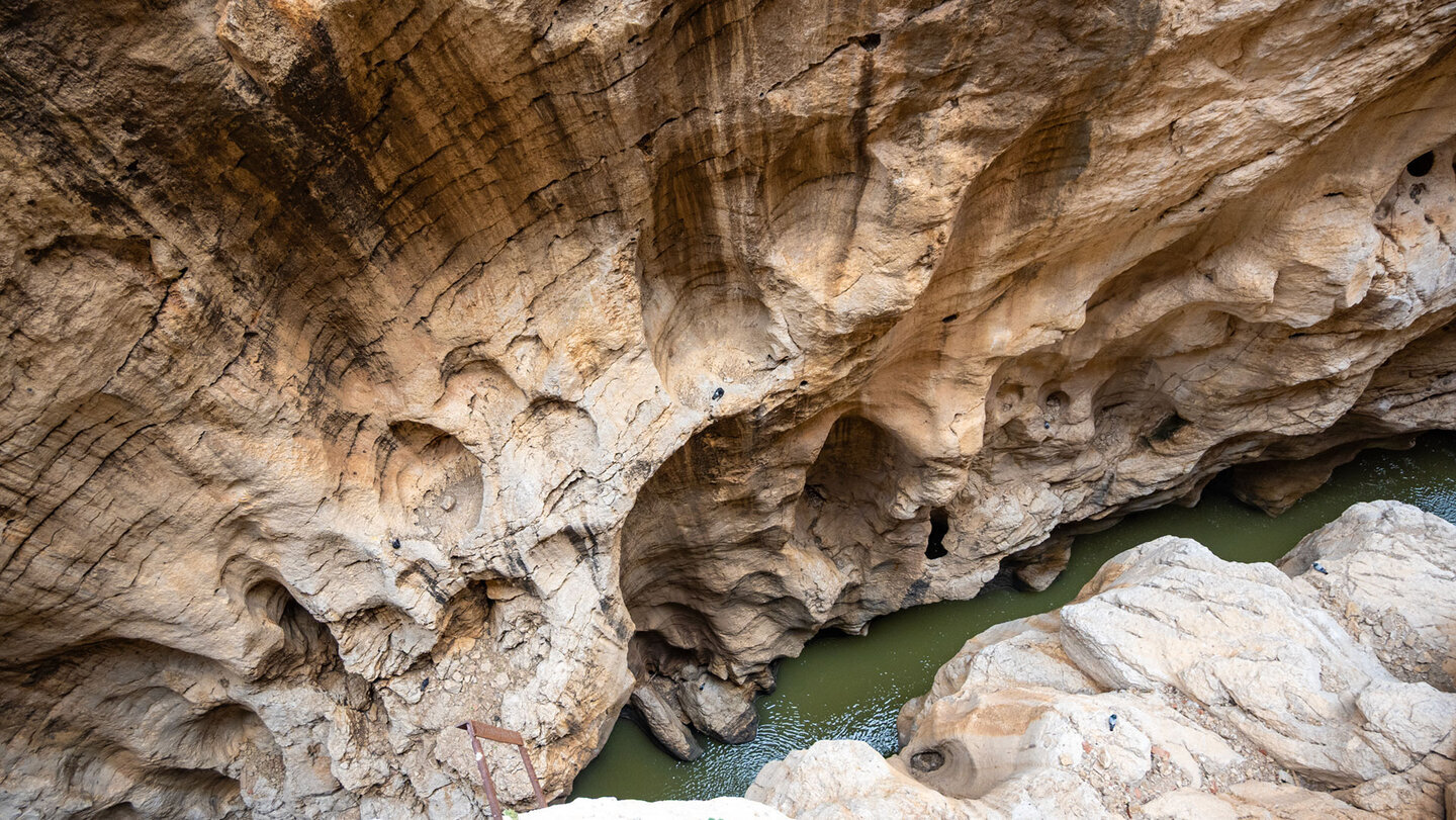
The Desfiladero de los Gaitanes is the result of one of the region’s most powerful geological forces: river erosion. Over millions of years, the Río Guadalhorce has carved its way into the limestone, which formed here – similarly to El Torcal – from marine sediments during the Jurassic period. What remains is one of the deepest and narrowest gorges on the Iberian Peninsula.
The rock faces show the same horizontal strata as the karst mountains of El Torcal – layers of sediment from the Jurassic sea, uplifted by tectonic forces and exposed by water. The difference: at El Torcal, it was rain and frost that shaped the forms. Here, it was a river that relentlessly carved its way through the rock. The gorge is the most dynamic part of this landscape – it is still changing today, centimetre by centimetre, year by year.
The Gaitanejo gorge in the northern section is particularly impressive: here the valley narrows to a width that lets only a thin strip of sunlight through. Further south, the terrain briefly opens out in the green Hoyo valley, before the Gaitanes gorge in the south, with its vertical rock faces, surpasses everything seen so far.
Fauna & flora: Life in the gorge
Birds of prey, ibex and oleander
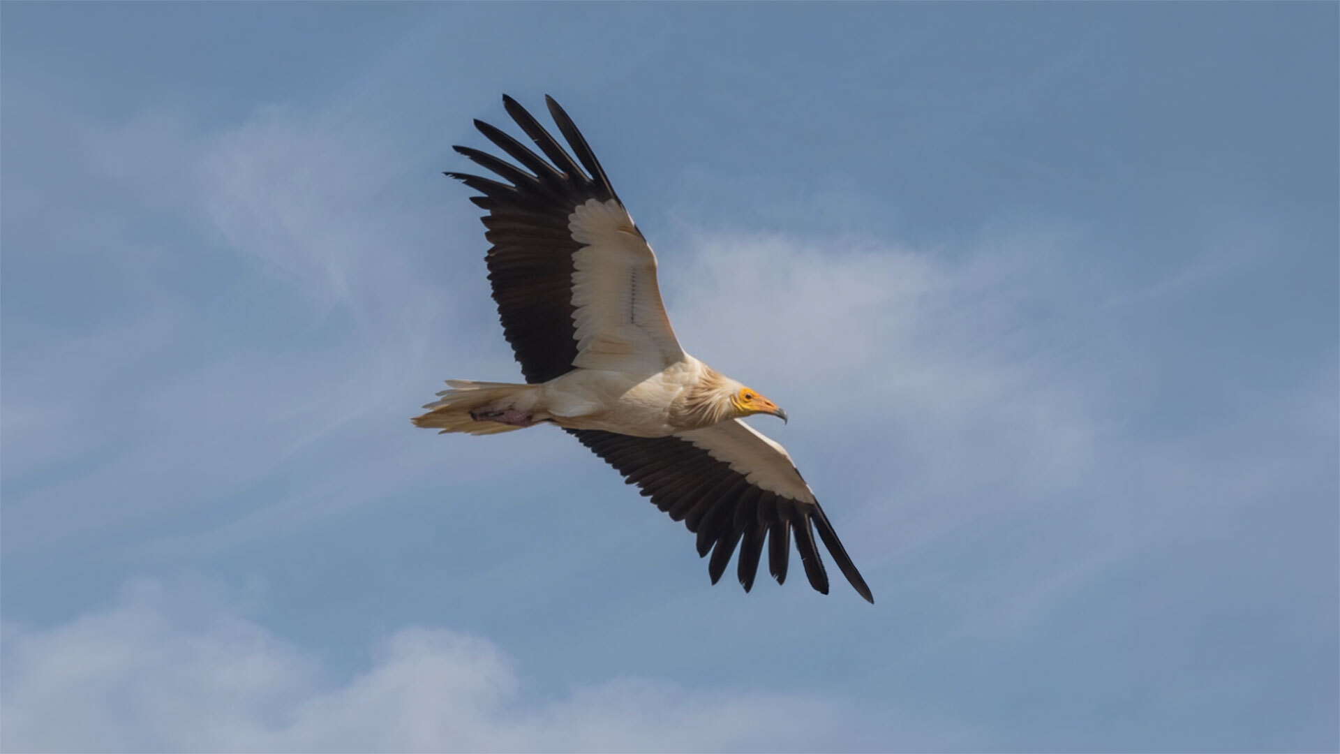
The ZEPA Desfiladero de los Gaitanes bird protection area is home to one of the most significant communities of birds of prey in southern Spain. Bearded vultures (lammergeiers), Bonelli’s eagles and golden eagles regularly circle above the gorge – three species that are rare or have disappeared in many parts of Europe, but which maintain stable populations here. In the warmer months, common swifts fill the air above the rock faces.
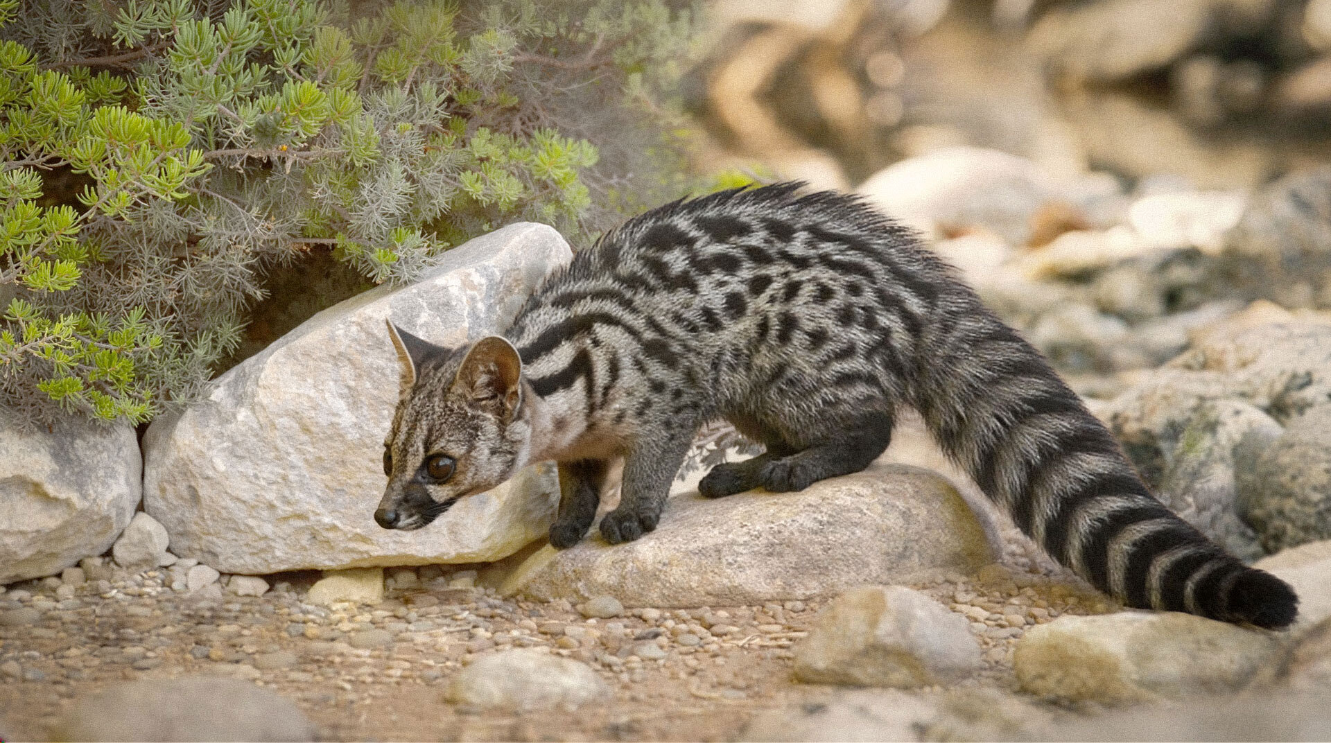
On the ground, the nature reserve is just as vibrant. Wildcats and common genets roam through the undergrowth, while the Spanish ibex keeps to the most inaccessible parts of the gorge – occasionally spotted on rocky paths no human would dare to walk. Along the banks of the Guadalhorce grow oleander bushes, tamarisks and reeds – a damp refuge amid the dry rocky world. The forests above consist of Aleppo pines, wild olive trees and holm oaks, with the undergrowth interwoven with rosemary and rockrose.
The nature reserve is part of a larger ecological corridor connecting the mountains of inland Andalusia with the coast. Migratory birds use the gorge as a guide line – in spring and autumn you can watch flocks of migrating birds using the thermal columns above the rock faces to cover hundreds of kilometres without flapping their wings.
Practical tips for your visit
Getting there, access and information – Desfiladero de los Gaitanes
Getting there: From Antequera, take the A-343 towards Álora, then head towards El Chorro. Approx. 40 km / 45 minutes by car. The village of El Chorro lies directly at the southern exit of the Caminito del Rey and is the starting point for exploring the gorge.
Caminito del Rey: The best-known access to the gorge is via the Caminito del Rey – tickets are compulsory and must be booked in advance via caminitodelrey.info. General admission €10.00 (as of May 2026).
Birdwatching: The best chances of spotting bearded vultures and eagles are in the early morning and late afternoon, when thermals above the rock faces are at their best. Binoculars are an absolute must for your rucksack.
Best time to visit: Spring (March–May) – oleander is in bloom, migratory birds are active, and temperatures are pleasant. Autumn (September–November) is also very good. In summer, the gorge can get very hot.
El Chorro as a base: The village of El Chorro offers restaurants, tapas bars, small guesthouses and a campsite. It’s an ideal base for a several-hour excursion from Antequera.
Conclusion: The Desfiladero de los Gaitanes is far more than just a backdrop for the Caminito
Most visitors know the Desfiladero de los Gaitanes only as the backdrop to the Caminito del Rey. Those who look more closely discover a nature reserve of rare intensity: bearded vultures above 400-metre walls, ibex in inaccessible rocky niches, a river that has been writing its own history for millions of years. The gorge is the experience – the Kings’ Path merely passes through it.
More excursions in the region: Caminito del Rey from Antequera · All excursions at a glance.
Frequently asked questions about the Desfiladero de los Gaitanes
Is the Desfiladero de los Gaitanes the same as the Caminito del Rey?
What is the difference between the Desfiladero de los Gaitanes and the Desfiladero del Gaitanejo?
What animals can you see in the Desfiladero de los Gaitanes?
How do you get back from the Desfiladero de los Gaitanes to Antequera?
This article is based on the on-the-ground knowledge of the Gequo editorial team – publishers of several Reisezeit hiking guides and operators of Sunhikes.com. Last updated: May 2026